Geolocate

Leeward Islands topographic map

Click on the map to display elevation.

About this map

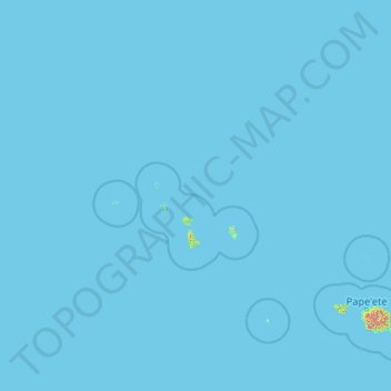
Name: Leeward Islands topographic map, elevation, terrain.

Location: Leeward Islands, French Polynesia, France (-17.13335 -154.93498 -15.59694 -150.73754)

Average elevation: 2 m

Minimum elevation: 0 m

Maximum elevation: 1,875 m

Other topographic maps

Click on a map to view its topography, its elevation and its terrain.

Tatakoto

France > French Polynesia > Tatakoto

Average elevation: 0 m

Maraa

France > French Polynesia > Windward Islands > Punaʻauiʻa

Average elevation: 678 m

Motu Tane

France > French Polynesia

Average elevation: 1 m

Tiputa

France > French Polynesia > Tuamotu-Gambier > Rangiroa

Average elevation: 0 m

Polynesia

France > French Polynesia

Average elevation: 1 m

Vaitape

France > French Polynesia > Bora-Bora > Vaitape

Average elevation: 22 m

Mekiro

France > French Polynesia > Gambier

Average elevation: 12 m

Motu Teiku

France > French Polynesia > Gambier

Average elevation: 0 m

Tekava

France > French Polynesia > Gambier

Average elevation: 0 m

Faa'a

France > French Polynesia > Faaa

Average elevation: 82 m

Coral reefs (high)

France > French Polynesia

Average elevation: 6 m

Gear up for your next adventure:

💡LED Camping Lantern - Illuminate your campsite with long-lasting lanterns
🧢Hiking Hat - Sun-protective and breathable hats for long treks
🧴Waterproofing Spray - Restore the DWR coating on jackets and tents
🗺️Topographic Maps - Detailed maps to explore trails, mountains, and wilderness areas
🔦UV Flashlight - Detect minerals or specific insects in the dark

As an Amazon Associate, this site earns from qualifying purchases at no extra cost to you.