Geolocate

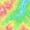
Garessio topographic map

Click on the map to display elevation.

About this map

Name: Garessio topographic map, elevation, terrain.

Location: Garessio, Cuneo, Piedmont, 12075, Italy (44.14164 7.86262 44.25424 8.09728)

Average elevation: 961 m

Minimum elevation: 129 m

Maximum elevation: 2,112 m

Other topographic maps

Click on a map to view its topography, its elevation and its terrain.

Camo

Italy > Piedmont > Cuneo > Santo Stefano Belbo

Average elevation: 337 m

Strepeis

Italy > Piedmont > Cuneo > Bagni di Vinadio

Average elevation: 1,758 m

San Bernolfo

Italy > Piedmont > Cuneo > Vinadio

Average elevation: 2,036 m

Gear up for your next adventure:

🧢Hiking Hat - Sun-protective and breathable hats for long treks
💧Collapsible Water Bottle - Space-saving water bottle for outdoor activities
🥾Trekking Boots - Durable boots for long-distance trekking
🥾Mountain Trail Shoes - High-traction shoes for mountain trails
🚲Heavy Duty Bike Lock - Secure your bike at the trailhead or during stops

As an Amazon Associate, this site earns from qualifying purchases at no extra cost to you.