Geolocate

Sliven topographic map

Click on the map to display elevation.

About this map

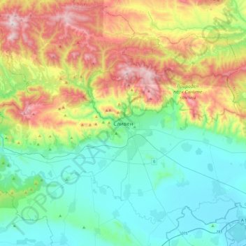
Name: Sliven topographic map, elevation, terrain.

Location: Sliven, 8801, Bulgaria (42.52176 26.15535 42.84176 26.47535)

Average elevation: 451 m

Minimum elevation: 128 m

Maximum elevation: 1,207 m

Gear up for your next adventure:

🦶Hiking Shoe Insoles - Added support for high arches and long days on feet
🧥Thermal Layer - Insulating layer for cold outdoor conditions
🏃Hydration Running Vest - Carry water and maps close to your body for speed
Camping Groundsheet - Protect your tent from moisture and dirt
🧭GPS Handheld Device - Reliable GPS navigation for outdoor adventures

As an Amazon Associate, this site earns from qualifying purchases at no extra cost to you.