Geolocate

Studena topographic map

Click on the map to display elevation.

About this map

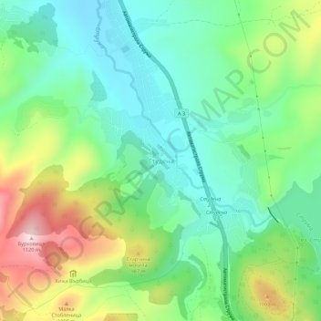
Name: Studena topographic map, elevation, terrain.

Location: Studena, Pernik, 2308, Bulgaria (42.52069 23.10323 42.56069 23.14323)

Average elevation: 875 m

Minimum elevation: 755 m

Maximum elevation: 1,114 m

Gear up for your next adventure:

🪑Ultralight Camping Stool - Compact seating for rest stops during long hikes
🛶Canoe Life Vest - Safety vest for water sports
🩹Moleskin Blister Pads - Direct protection for painful foot pressure points
🥽Outdoor Goggles - Protective eyewear for outdoor activities
🥾Durable Hiking Shoes - Long-lasting shoes for frequent hiking

As an Amazon Associate, this site earns from qualifying purchases at no extra cost to you.