
Paradise Point topographic map
Interactive map
Click on the map to display elevation.
About this map
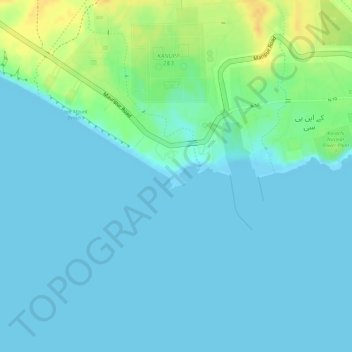
Name: Paradise Point topographic map, elevation, terrain.
Location: Paradise Point, KNPC, Sindh, Karachi Division, Pakistan (24.84206 66.77480 24.84413 66.77905)
Average elevation: 7 m
Minimum elevation: 0 m
Maximum elevation: 31 m
Other topographic maps
Click on a map to view its topography, its elevation and its terrain.
Gulistan-e-Jauhar
Gulistan-e-Jauhar, Gulshan Town, Sindh, 75300, Pakistan
Average elevation: 37 m
DHA Phase 7
DHA Phase 7, Defence, Karachi, Sindh, 77500, Pakistan
Average elevation: 7 m
Landhi Town
Landhi Town, Karachi, Karāchi District, Sindh, 75120, Pakistan
Average elevation: 19 m
Indus River
Indus River, Lab-e-Mehran Road, Old Sukkur, Sukkur, Shikārpur District, Sindh, Pakistan
Average elevation: 64 m