Geolocate

Muara Delang topographic map

Click on the map to display elevation.

About this map

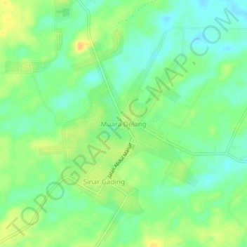
Name: Muara Delang topographic map, elevation, terrain.

Location: Muara Delang, Merangin, Jambi, Sumatra, Indonesia (-1.99784 102.36042 -1.95784 102.40042)

Average elevation: 65 m

Minimum elevation: 52 m

Maximum elevation: 81 m

Other topographic maps

Click on a map to view its topography, its elevation and its terrain.

Air Tembesi

Indonesia > Jambi > Merangin > Koto Teguh

Average elevation: 1,176 m

Batang Tantan

Indonesia > Jambi > Merangin

Average elevation: 150 m

Sungai Keruh

Indonesia > Jambi > Merangin > Rantau Kermas

Average elevation: 1,194 m

Sungai Putih

Indonesia > Jambi > Merangin > Sungai Putih

Average elevation: 122 m

Gear up for your next adventure:

🧣Merino Neck Gaiter - Protects against wind, sun, and cold at high altitudes
🥘Camping Cookware Set - Compact nesting pots and pans for trail cooking
🔭Compact Monocular - One-handed bird watching and trail spotting
🪑Ultralight Camping Stool - Compact seating for rest stops during long hikes
🔨Vehicle Emergency Tool - Safety tool for remote road trips to trailheads

As an Amazon Associate, this site earns from qualifying purchases at no extra cost to you.