Geolocate

Lleida topographic map

Click on the map to display elevation.

About this map
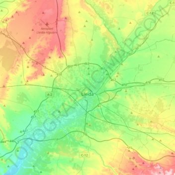
Name: Lleida topographic map, elevation, terrain.

Location: Lleida, Segrià, Lleida, Catalonia, Spain (41.51035 0.36360 41.73957 0.74198)

Average elevation: 222 m

Minimum elevation: 96 m

Maximum elevation: 456 m

Other topographic maps

Click on a map to view its topography, its elevation and its terrain.
Quarts

Spain > Catalonia > Segrià > Corbins

Average elevation: 183 m

Gualda

Spain > Catalonia > Segrià > Lleida

Average elevation: 184 m

Gear up for your next adventure:

🧰Survival Kit - Essential gear for emergencies in the wilderness
🔦UV Flashlight - Detect minerals or specific insects in the dark
🧥Waterproof Hiking Jacket - Protect yourself from rain and wind while hiking
🧥Waterproof Pants - Keep dry during rainy hiking conditions
🧥Packable Rain Jacket - Breathable waterproof layer for unpredictable weather

As an Amazon Associate, this site earns from qualifying purchases at no extra cost to you.