Geolocate

St. Bees topographic map

Click on the map to display elevation.

About this map
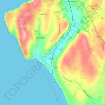
Name: St. Bees topographic map, elevation, terrain.

Location: St. Bees, St Bees, Cumberland, England, United Kingdom (54.46366 -3.64062 54.52513 -3.55099)

Average elevation: 50 m

Minimum elevation: 0 m

Maximum elevation: 142 m

Gear up for your next adventure:

👖Convertible Hiking Pants - Zip-off legs to adapt to changing weather conditions
🥾Light Trekking Boots - Supportive boots for multi-day treks
🥾Trail Hiking Socks - Comfortable socks to prevent blisters and fatigue
🥾Lightweight Hiking Boots - Boots for comfort and mobility on long hikes
🧦Outdoor Socks - Durable socks designed for hiking and outdoor sports

As an Amazon Associate, this site earns from qualifying purchases at no extra cost to you.