Geolocate

Peshtera topographic map

Click on the map to display elevation.

About this map

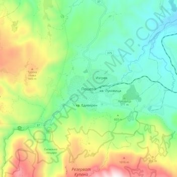
Name: Peshtera topographic map, elevation, terrain.

Location: Peshtera, Pazardzhik, Bulgaria (41.99365 24.26521 42.07365 24.34521)

Average elevation: 627 m

Minimum elevation: 275 m

Maximum elevation: 1,322 m

Other topographic maps

Click on a map to view its topography, its elevation and its terrain.

Pazardzik

Bulgaria > Pazardzhik

Average elevation: 300 m

Gear up for your next adventure:

🩹Moleskin Blister Pads - Direct protection for painful foot pressure points
🥾Light Hiking Boots - Lightweight and comfortable boots for day hikes
Camping Groundsheet - Protect your tent from moisture and dirt
👟Leg Gaiters - Keep debris, mud, and snow out of your boots
🛌Down Sleeping Bag - Superior warmth-to-weight ratio for cold nights

As an Amazon Associate, this site earns from qualifying purchases at no extra cost to you.