Geolocate

Calthorpe Fields topographic map

Click on the map to display elevation.

About this map

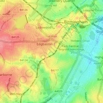
Name: Calthorpe Fields topographic map, elevation, terrain.

Location: Calthorpe Fields, Park Central, Birmingham, West Midlands, England, B15 1JB, United Kingdom (52.44807 -1.93822 52.48807 -1.89822)

Average elevation: 141 m

Minimum elevation: 104 m

Maximum elevation: 178 m

Other topographic maps

Click on a map to view its topography, its elevation and its terrain.

Gear up for your next adventure:

🔥Emergency Fire Starter - Reliable ignition source for all weather conditions
🧦Hiking Socks - Moisture-wicking and comfortable socks for long hikes
🧊Portable Cooler - Keep food and drinks cold during outdoor adventures
🥾Trail Hiking Boots - Supportive boots for rough trails
🔦LED Headlamp - Hands-free lighting for early morning starts or late finishes

As an Amazon Associate, this site earns from qualifying purchases at no extra cost to you.