Geolocate

Mersi topographic map

Click on the map to display elevation.

About this map
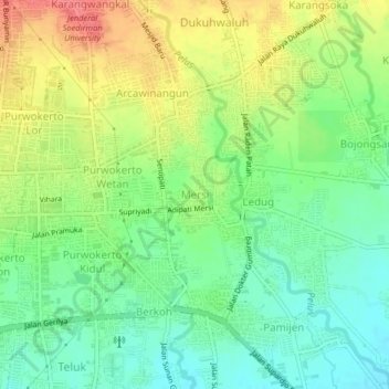
Name: Mersi topographic map, elevation, terrain.

Location: Mersi, Banyumas, Central Java, 53112, Indonesia (-7.44564 109.24492 -7.40564 109.28492)

Average elevation: 76 m

Minimum elevation: 48 m

Maximum elevation: 114 m

Other topographic maps

Click on a map to view its topography, its elevation and its terrain.

Kali Tajum

Indonesia > Central Java > Banyumas > Tipar Kidul

Average elevation: 99 m

Kali Tajum

Indonesia > Central Java > Banyumas > Tipar Kidul

Average elevation: 93 m

Logawa

Indonesia > Central Java > Banyumas > Karanganyar

Average elevation: 66 m

Gear up for your next adventure:

👟Trail Running Shoes - Agile footwear for fast-paced topographic exploration
🥾Trekking Poles - Adjustable trekking poles to reduce knee stress and improve stability
🥾Lightweight Hiking Boots - Boots for comfort and mobility on long hikes
⛺Backpacking Tent - Lightweight tent for long-distance hiking trips
💡Solar Camping Lamp - Eco-friendly lighting for campsites

As an Amazon Associate, this site earns from qualifying purchases at no extra cost to you.