Geolocate

Logawa topographic map

Click on the map to display elevation.

About this map

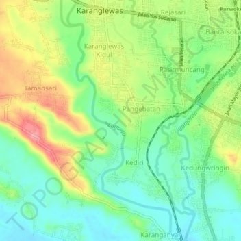
Name: Logawa topographic map, elevation, terrain.

Location: Logawa, Karanganyar, Banyumas, Central Java, Java, Indonesia (-7.45883 109.19395 -7.41915 109.21351)

Average elevation: 66 m

Minimum elevation: 22 m

Maximum elevation: 135 m

Gear up for your next adventure:

🧭GPS Outdoor Watch - Smart watch for navigation and fitness tracking in nature
🧥Softshell Jacket - Windproof and breathable jacket for hiking
🧦Outdoor Socks - Durable socks designed for hiking and outdoor sports
🔋Solar Power Bank - Keep your GPS and devices charged during long outdoor trips
Lightweight Backpacking Tent - Compact tent for efficient hiking trips

As an Amazon Associate, this site earns from qualifying purchases at no extra cost to you.