Geolocate

Les Rouquilloux topographic map

Click on the map to display elevation.

About this map
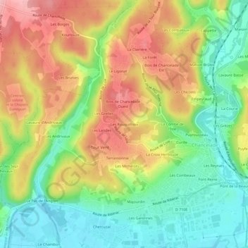
Name: Les Rouquilloux topographic map, elevation, terrain.

Location: Les Rouquilloux, Chancelade, Périgueux, Dordogne, Nouvelle-Aquitaine, France métropolitaine, 24650, France (45.18971 0.62765 45.22971 0.66765)

Average elevation: 136 m

Minimum elevation: 73 m

Maximum elevation: 209 m

Other topographic maps

Click on a map to view its topography, its elevation and its terrain.

24650

France > Nouvelle-Aquitaine > Dordogne > Chancelade

Average elevation: 135 m

Gear up for your next adventure:

🥾Hiking Shorts - Breathable shorts suitable for summer hikes
🧥Softshell Jacket - Windproof and breathable jacket for hiking
🏃Hydration Running Vest - Carry water and maps close to your body for speed
🔋Emergency Crank Radio - Weather alerts and power without needing batteries
💡Portable Camping Lamp - Rechargeable lamp for campsite lighting

As an Amazon Associate, this site earns from qualifying purchases at no extra cost to you.