Geolocate

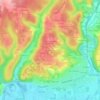
24650 topographic map

Click on the map to display elevation.

About this map

Name: 24650 topographic map, elevation, terrain.

Location: 24650, Chancelade, Périgueux, Dordogne, Nouvelle-Aquitaine, France métropolitaine, France (45.18579 0.61917 45.23569 0.68836)

Average elevation: 135 m

Minimum elevation: 73 m

Maximum elevation: 226 m

Other topographic maps

Click on a map to view its topography, its elevation and its terrain.

Les Andrivaux

France > Nouvelle-Aquitaine > Dordogne > Chancelade

Average elevation: 144 m

Majourdin

France > Nouvelle-Aquitaine > Dordogne > Chancelade

Average elevation: 120 m

Puyrousseau

France > Nouvelle-Aquitaine > Dordogne > Chancelade

Average elevation: 130 m

Les Chabrat

France > Nouvelle-Aquitaine > Dordogne > Chancelade

Average elevation: 121 m

La Sauge

France > Nouvelle-Aquitaine > Dordogne > Chancelade

Average elevation: 151 m

Les Landes

France > Nouvelle-Aquitaine > Dordogne > Chancelade

Average elevation: 139 m

La Forêt

France > Nouvelle-Aquitaine > Dordogne > Chancelade

Average elevation: 153 m

L'Évêque

France > Nouvelle-Aquitaine > Dordogne > Chancelade

Average elevation: 119 m

L'Évêque

France > Nouvelle-Aquitaine > Dordogne > Chancelade

Average elevation: 119 m

Gear up for your next adventure:

🧥Insulated Jacket - Keep warm in cold outdoor conditions
💧Filtered Water Bottle - Safe drinking water on the go
🧥Packable Rain Jacket - Breathable waterproof layer for unpredictable weather
🥾Light Hiking Boots - Lightweight and comfortable boots for day hikes
🥾Hiking Leggings - Comfortable leggings for outdoor activities

As an Amazon Associate, this site earns from qualifying purchases at no extra cost to you.