Geolocate

Mount Satima topographic map

Click on the map to display elevation.

About this map

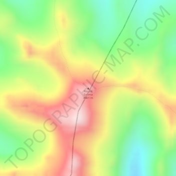
Name: Mount Satima topographic map, elevation, terrain.

Location: Mount Satima, Nyandarua, Central Kenya, Kenya (-0.30608 36.61780 -0.30598 36.61790)

Average elevation: 3,805 m

Minimum elevation: 3,607 m

Maximum elevation: 3,997 m

Other topographic maps

Click on a map to view its topography, its elevation and its terrain.

Kinangop

Kenya > Nyandarua

Average elevation: 2,423 m

Kipipiri

Kenya > Nyandarua

Average elevation: 2,669 m

Ol Kalou

Kenya > Nyandarua

Average elevation: 2,298 m

Ndaragwa

Kenya > Nyandarua

Average elevation: 2,380 m

Gear up for your next adventure:

Backpacking Tent - Lightweight tent for long-distance hiking trips
🔭Outdoor Binoculars - Lightweight binoculars for birdwatching and hiking
🛶Canoe Life Vest - Safety vest for water sports
🧥Softshell Hiking Jacket - The perfect balance of wind protection and breathability
🚲Handlebar Phone Mount - View topographic-map.com live while cycling

As an Amazon Associate, this site earns from qualifying purchases at no extra cost to you.