Geolocate

Ambleston topographic map

Click on the map to display elevation.

About this map

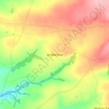
Name: Ambleston topographic map, elevation, terrain.

Location: Ambleston, Pembrokeshire, Wales, SA62 5QY, United Kingdom (51.87498 -4.92668 51.91498 -4.88668)

Average elevation: 129 m

Minimum elevation: 54 m

Maximum elevation: 194 m

Gear up for your next adventure:

🦯Trekking Poles - Reduced impact on joints for steep topographic climbs
🥾Mountain Hiking Shoes - Shoes with superior grip for mountainous terrain
🥾Light Trekking Boots - Supportive boots for multi-day treks
🥤Collapsible Travel Cup - Saves space and weight in your mess kit
🥽Outdoor Goggles - Protective eyewear for outdoor activities

As an Amazon Associate, this site earns from qualifying purchases at no extra cost to you.