Geolocate

Columbus topographic map

Click on the map to display elevation.

About this map

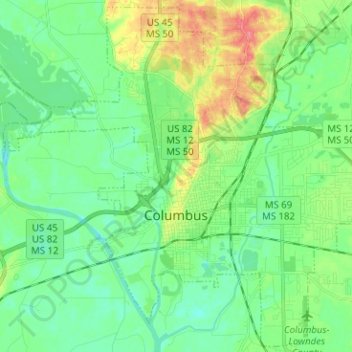
Name: Columbus topographic map, elevation, terrain.

Location: Columbus, Lowndes County, Mississippi, United States (33.45627 -88.48938 33.55787 -88.36310)

Average elevation: 55 m

Minimum elevation: 35 m

Maximum elevation: 101 m

Other topographic maps

Click on a map to view its topography, its elevation and its terrain.

Billups

United States > Mississippi > Lowndes County

Average elevation: 72 m

Penns

United States > Mississippi > Lowndes County > Penns

Average elevation: 84 m

Gear up for your next adventure:

🪑Insulated Seat Pad - Protect your seat from cold rocks and wet logs
💡LED Headlamp - Hands-free illumination for night hiking and camping
🧦Hiking Socks - Moisture-wicking and comfortable socks for long hikes
🧦Thermal Socks - Warm socks for winter hiking or camping
🚲Bike Repair Kit - Essential tools for on-trail mechanical issues

As an Amazon Associate, this site earns from qualifying purchases at no extra cost to you.