Geolocate

Penns topographic map

Click on the map to display elevation.

About this map

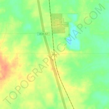
Name: Penns topographic map, elevation, terrain.

Location: Penns, Lowndes County, Mississippi, 39743, United States (33.33234 -88.65588 33.37234 -88.61588)

Average elevation: 84 m

Minimum elevation: 62 m

Maximum elevation: 104 m

Gear up for your next adventure:

🛁Quick-Dry Microfiber Towel - Space-saving towel that dries rapidly on the move
🥾Trail Running Boots - Durable shoes designed for trail running
👖Convertible Hiking Pants - Zip-off legs to adapt to changing weather conditions
🥾Hiking Shorts - Breathable shorts suitable for summer hikes
🧢Hiking Hat - Sun-protective and breathable hats for long treks

As an Amazon Associate, this site earns from qualifying purchases at no extra cost to you.