
Make a donation
Gear up for your next adventure:
As an Amazon Associate, this site earns from qualifying purchases at no extra cost to you.
Les Prats topographic map
Click on the map to display elevation.
Make a donation
Gear up for your next adventure:
As an Amazon Associate, this site earns from qualifying purchases at no extra cost to you.
About this map
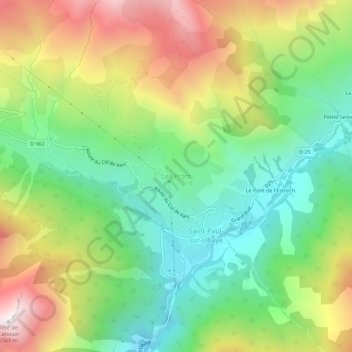
Name: Les Prats topographic map, elevation, terrain.
Average elevation: 1,844 m
Minimum elevation: 1,381 m
Maximum elevation: 2,538 m
Make a donation
Gear up for your next adventure:
As an Amazon Associate, this site earns from qualifying purchases at no extra cost to you.
Other topographic maps
Click on a map to view its topography, its elevation and its terrain.
La Palud-sur-Verdon
Frankrijk > Provence-Alpes-Côte d'Azur > Alpes-de-Haute-Provence
Average elevation: 1,109 m
Moustiers-Sainte-Marie
Frankrijk > Provence-Alpes-Côte d'Azur > Alpes-de-Haute-Provence
Average elevation: 874 m
Saint-André-les-Alpes
Frankrijk > Provence-Alpes-Côte d'Azur > Alpes-de-Haute-Provence
Average elevation: 1,216 m
Ubaye-Serre-Ponçon
Frankrijk > Provence-Alpes-Côte d'Azur > Alpes-de-Haute-Provence
Average elevation: 1,204 m
Make a donation
Gear up for your next adventure:
As an Amazon Associate, this site earns from qualifying purchases at no extra cost to you.
Saint-Jeannet
Frankrijk > Provence-Alpes-Côte d'Azur > Alpes-de-Haute-Provence
Average elevation: 770 m
Moustiers-Sainte-Marie
Frankrijk > Provence-Alpes-Côte d'Azur > Alpes-de-Haute-Provence
Average elevation: 874 m
Make a donation
Gear up for your next adventure:
As an Amazon Associate, this site earns from qualifying purchases at no extra cost to you.
Castellane
Frankrijk > Provence-Alpes-Côte d'Azur > Alpes-de-Haute-Provence
De oppervlakte van Castellane bedroeg op 1 januari 2021 117,79 vierkante kilometer; de bevolkingsdichtheid was toen 12,4 inwoners per km². Castellane ligt in de vallei van de Verdon, op 724 m hoogte. In de gemeente liggen verschillende gehuchten: Eoulx, La Baume, Petit Robion, Robion en Taloire.
Average elevation: 1,092 m
Make a donation
Gear up for your next adventure:
As an Amazon Associate, this site earns from qualifying purchases at no extra cost to you.
Digne-les-Bains
Frankrijk > Provence-Alpes-Côte d'Azur > Alpes-de-Haute-Provence
Average elevation: 869 m
Lac d'Allos
Frankrijk > Provence-Alpes-Côte d'Azur > Alpes-de-Haute-Provence > Allos
Average elevation: 2,374 m
Make a donation
Gear up for your next adventure:
As an Amazon Associate, this site earns from qualifying purchases at no extra cost to you.
Make a donation
Gear up for your next adventure:
As an Amazon Associate, this site earns from qualifying purchases at no extra cost to you.
Sainte-Croix-du-Verdon
Frankrijk > Provence-Alpes-Côte d'Azur > Alpes-de-Haute-Provence
Average elevation: 560 m
Make a donation
Gear up for your next adventure:
As an Amazon Associate, this site earns from qualifying purchases at no extra cost to you.
Make a donation
Gear up for your next adventure:
As an Amazon Associate, this site earns from qualifying purchases at no extra cost to you.
Le Lauzet-Ubaye
Frankrijk > Provence-Alpes-Côte d'Azur > Alpes-de-Haute-Provence
Average elevation: 1,650 m
Make a donation
Gear up for your next adventure:
As an Amazon Associate, this site earns from qualifying purchases at no extra cost to you.
Esparron-de-Verdon
Frankrijk > Provence-Alpes-Côte d'Azur > Alpes-de-Haute-Provence
Average elevation: 482 m
Gréoux-les-Bains
Frankrijk > Provence-Alpes-Côte d'Azur > Alpes-de-Haute-Provence
Average elevation: 407 m
Saint-Martin-de-Brômes
Frankrijk > Provence-Alpes-Côte d'Azur > Alpes-de-Haute-Provence
Average elevation: 464 m
Make a donation
Gear up for your next adventure:
As an Amazon Associate, this site earns from qualifying purchases at no extra cost to you.
Céreste-en-Luberon
Frankrijk > Provence-Alpes-Côte d'Azur > Alpes-de-Haute-Provence
Average elevation: 491 m
Saint-Étienne-les-Orgues
Frankrijk > Provence-Alpes-Côte d'Azur > Alpes-de-Haute-Provence
Average elevation: 958 m
Make a donation
Gear up for your next adventure:
As an Amazon Associate, this site earns from qualifying purchases at no extra cost to you.
Barcelonnette
Frankrijk > Provence-Alpes-Côte d'Azur > Alpes-de-Haute-Provence
Average elevation: 1,478 m
Castellane
Frankrijk > Provence-Alpes-Côte d'Azur > Alpes-de-Haute-Provence
Castellane ligt in de vallei van de Verdon, op 724 m.hoogte.
Average elevation: 1,092 m
Make a donation
Gear up for your next adventure:
As an Amazon Associate, this site earns from qualifying purchases at no extra cost to you.
Valernes
Frankrijk > Provence-Alpes-Côte d'Azur > Alpes-de-Haute-Provence > Valernes
Average elevation: 665 m
Reillanne
Frankrijk > Provence-Alpes-Côte d'Azur > Alpes-de-Haute-Provence > Reillanne
Average elevation: 560 m
Méolans-Revel
Frankrijk > Provence-Alpes-Côte d'Azur > Alpes-de-Haute-Provence
Average elevation: 1,851 m
Saint-Paul-sur-Ubaye
Frankrijk > Provence-Alpes-Côte d'Azur > Alpes-de-Haute-Provence
Average elevation: 2,230 m
Make a donation
Gear up for your next adventure:
As an Amazon Associate, this site earns from qualifying purchases at no extra cost to you.
Blieux
Frankrijk > Provence-Alpes-Côte d'Azur > Alpes-de-Haute-Provence > Blieux
Average elevation: 1,244 m