Geolocate

Oxted topographic map

Click on the map to display elevation.

About this map
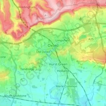
Name: Oxted topographic map, elevation, terrain.

Location: Oxted, Limpsfield, Tandridge, Surrey, England, United Kingdom (51.21233 -0.03626 51.28976 0.01667)

Average elevation: 128 m

Minimum elevation: 54 m

Maximum elevation: 271 m

Gear up for your next adventure:

⛺Camping Tent - Weather-resistant tents suitable for 2 to 6 people
🧥Waterproof Jacket - Lightweight rain jackets for hiking and outdoor activities
🧥Packable Rain Jacket - Breathable waterproof layer for unpredictable weather
🧰Emergency Multi-Tool - Compact multi-tool for outdoor survival
🧭Orienteering Kit - Tools for map reading and navigation in the wild

As an Amazon Associate, this site earns from qualifying purchases at no extra cost to you.