Geolocate

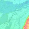
Moosburg topographic map

Click on the map to display elevation.

Moosburg

The oldest town between Regensburg and Italy lies on the river Isar at an altitude of 421 m (1381 ft). It has 20,237 inhabitants (2022) and covers an area of 44 km2. It is easily reached by the A 92 autobahn and regional trains on the Munich–Regensburg line. Furthermore, it takes just 20 minutes to get to Munich Airport.

Wikipedia (CC-BY-SA 3.0)

About this map

Name: Moosburg topographic map, elevation, terrain.

Location: Moosburg, Landkreis Freising, Bavaria, 85368, Germany (48.42698 11.86724 48.49993 12.01942)

Average elevation: 428 m

Minimum elevation: 397 m

Maximum elevation: 513 m

Other topographic maps

Click on a map to view its topography, its elevation and its terrain.
Troll

Germany > Bavaria > Landkreis Freising > Moosburg > Moos

Average elevation: 425 m

Mariabrunn

Germany > Bavaria > Landkreis Freising > Birkeneck

Average elevation: 453 m

Dietersheim

Germany > Bavaria > Landkreis Freising

Average elevation: 471 m

Günzenhausen

Germany > Bavaria > Landkreis Freising

Average elevation: 477 m

Spörerau

Germany > Bavaria > Landkreis Freising > Wang

Average elevation: 410 m

Gear up for your next adventure:

🧼Travel Hand Sanitizer - Keep hands clean when water is scarce
Camping Essentials - All-in-one gear for a comfortable camping trip
🧢Hiking Sun Hat - Wide-brimmed protection for exposed mountain ridges
🧴Outdoor Sunscreen - High SPF protection for high-altitude UV exposure
🪜Heavy Duty Carabiners - Multi-use clips for securing gear to your backpack

As an Amazon Associate, this site earns from qualifying purchases at no extra cost to you.