Geolocate

Cannich topographic map

Click on the map to display elevation.

About this map

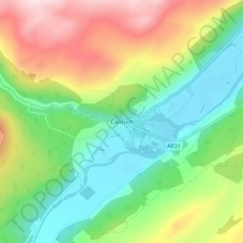
Name: Cannich topographic map, elevation, terrain.

Location: Cannich, Highland, Scotland, IV4 7LN, United Kingdom (57.32689 -4.78619 57.36689 -4.74619)

Average elevation: 204 m

Minimum elevation: 50 m

Maximum elevation: 463 m

Other topographic maps

Click on a map to view its topography, its elevation and its terrain.

Loch Ness

United Kingdom > Scotland > Highland > Dores

Average elevation: 340 m

Gear up for your next adventure:

🔦LED Headtorch - Bright and durable light for night activities
🥾Hiking Leggings - Comfortable leggings for outdoor activities
🥾Approach Shoes - Shoes designed for climbing approaches and rugged trails
🥾Trail Hiking Boots - Supportive boots for rough trails
👟Leg Gaiters - Keep debris, mud, and snow out of your boots

As an Amazon Associate, this site earns from qualifying purchases at no extra cost to you.