Geolocate

Amery topographic map

Click on the map to display elevation.

About this map
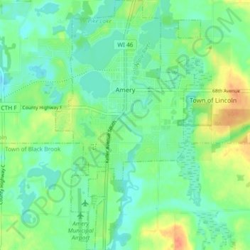
Name: Amery topographic map, elevation, terrain.

Location: Amery, Polk County, Wisconsin, United States (45.27395 -92.38261 45.32530 -92.34016)

Average elevation: 330 m

Minimum elevation: 316 m

Maximum elevation: 358 m

Gear up for your next adventure:

🥾Hiking Gaiters - Protect legs and shoes from mud, snow, and debris
🧢Outdoor Visor - Breathable visor for sunny hikes
🍽️Titanium Camping Spork - Ultralight and indestructible eating utensil
🔦UV Flashlight - Detect minerals or specific insects in the dark
🔦LED Headtorch - Bright and durable light for night activities

As an Amazon Associate, this site earns from qualifying purchases at no extra cost to you.