
Thank you for supporting this site ❤️
Make a donation
Make a donation
Gear up for your next adventure:
As an Amazon Associate, this site earns from qualifying purchases at no extra cost to you.
Coed y bachau topographic map
Click on the map to display elevation.
Thank you for supporting this site ❤️
Make a donation
Make a donation
Gear up for your next adventure:
As an Amazon Associate, this site earns from qualifying purchases at no extra cost to you.
About this map
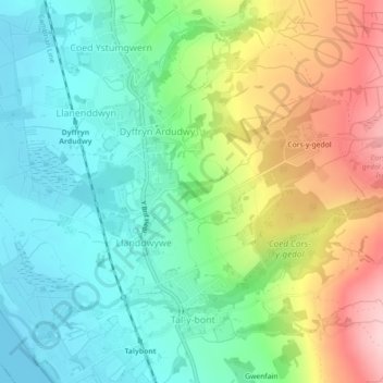
Name: Coed y bachau topographic map, elevation, terrain.
Location: Coed y bachau, Dyffryn Ardudwy, Gwynedd, Wales, United Kingdom (52.78262 -4.09285 52.78429 -4.08856)
Average elevation: 75 m
Minimum elevation: 0 m
Maximum elevation: 216 m
Thank you for supporting this site ❤️
Make a donation
Make a donation
Gear up for your next adventure:
As an Amazon Associate, this site earns from qualifying purchases at no extra cost to you.