Geolocate

Petit-Serré topographic map

Click on the map to display elevation.

About this map
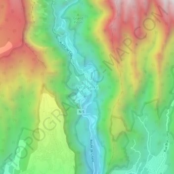
Name: Petit-Serré topographic map, elevation, terrain.

Location: Petit-Serré, Saint-Louis, Saint-Pierre, La Réunion, 97421, France (-21.23475 55.43471 -21.19475 55.47471)

Average elevation: 790 m

Minimum elevation: 240 m

Maximum elevation: 1,615 m

Other topographic maps

Click on a map to view its topography, its elevation and its terrain.

Ravine du Maniron

France > La Réunion > Saint-Louis

Average elevation: 6 m

97450

France > La Réunion > Saint-Louis > Bellevue

Average elevation: 478 m

Gear up for your next adventure:

🧣Merino Neck Gaiter - Protects against wind, sun, and cold at high altitudes
🥾Trekking Boots - Durable boots for long-distance trekking
🔦LED Headlamp - Hands-free lighting for early morning starts or late finishes
🧤Rechargeable Heated Gloves - Extreme warmth for Canadian winter expeditions
🧥Ultralight Puffy Jacket - Maximum warmth that packs down to the size of an orange

As an Amazon Associate, this site earns from qualifying purchases at no extra cost to you.