
Make a donation
Gear up for your next adventure:
As an Amazon Associate, this site earns from qualifying purchases at no extra cost to you.
Ravine du Maniron topographic map
Click on the map to display elevation.
Make a donation
Gear up for your next adventure:
As an Amazon Associate, this site earns from qualifying purchases at no extra cost to you.
About this map
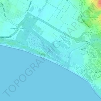
Name: Ravine du Maniron topographic map, elevation, terrain.
Average elevation: 6 m
Minimum elevation: 0 m
Maximum elevation: 49 m
Make a donation
Gear up for your next adventure:
As an Amazon Associate, this site earns from qualifying purchases at no extra cost to you.
Other topographic maps
Click on a map to view its topography, its elevation and its terrain.
Les Makes
France > La Réunion > Saint-Louis
Les Makes sont un lieu-dit de l'île de La Réunion, un département d'outre-mer français dans le sud-ouest de l'océan Indien. Il est situé autour de (mille) 1 000 mètres d'altitude, sur un plateau incliné appelé plaine des Makes et relevant de la commune de Saint-Louis. Labellisé Villages Créoles, il…
Average elevation: 987 m
Make a donation
Gear up for your next adventure:
As an Amazon Associate, this site earns from qualifying purchases at no extra cost to you.
Make a donation
Gear up for your next adventure:
As an Amazon Associate, this site earns from qualifying purchases at no extra cost to you.