Geolocate

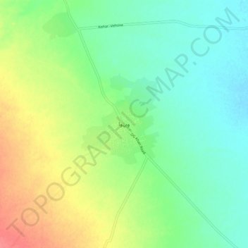
Wahova topographic map

Click on the map to display elevation.

Wahova

Wahova, is a town in Taunsa District of Punjab, Pakistan. Largely inhabited by the Khetran tribe, it is also called Tuman Khetran. The main languages spoken here are Saraiki and Balochi. Located in northern part of the Taunsa District at 31°7'58N 70°30'46E, the tehsil has an elevation of 196 metres.

Wikipedia (CC-BY-SA 3.0)

About this map

Name: Wahova topographic map, elevation, terrain.

Location: Wahova, Taunsa Tehsil, Taunsa District, Dera Ghazi Khan Division, Punjab, Pakistan (31.09036 70.46726 31.17036 70.54726)

Average elevation: 213 m

Minimum elevation: 190 m

Maximum elevation: 253 m

Gear up for your next adventure:

🕯️Camping Lantern - Illuminates your entire campsite with high-efficiency LEDs
🐕Hiking Dog Pack - Let your canine companion carry their own water and food
🎒Hiking Backpack - Lightweight and ergonomic backpacks for day hikes or multi-day treks
🧴Waterproofing Spray - Restore the DWR coating on jackets and tents
🎒Backpack Rain Cover - External shield to keep your entire pack dry

As an Amazon Associate, this site earns from qualifying purchases at no extra cost to you.