Geolocate

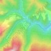
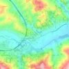
Teramo topographic map

Click on the map to display elevation.

About this map

Name: Teramo topographic map, elevation, terrain.

Location: Teramo, Abruzzo, 64100, Italy (42.59510 13.58228 42.71934 13.82804)

Average elevation: 437 m

Minimum elevation: 101 m

Maximum elevation: 1,701 m

Other topographic maps

Click on a map to view its topography, its elevation and its terrain.
Appennino abruzzese

Italy > Abruzzo > Teramo > Pietracamela

Average elevation: 2,251 m

Intermesoli

Italy > Abruzzo > Teramo > Pietracamela

Average elevation: 888 m

Nerito

Italy > Abruzzo > Teramo

Average elevation: 939 m

Favale

Italy > Abruzzo > Teramo > Civitella del Tronto

Average elevation: 185 m

Marciano

Italy > Abruzzo > Teramo > Montefino

Average elevation: 259 m

Villa Vomano

Italy > Abruzzo > Teramo > Teramo

Average elevation: 201 m

Gear up for your next adventure:

🛌Down Sleeping Bag - Superior warmth-to-weight ratio for cold nights
🧊Portable Cooler - Keep food and drinks cold during outdoor adventures
🍽️Titanium Camping Spork - Ultralight and indestructible eating utensil
🧢Hiking Hat - Sun-protective and breathable hats for long treks
🥾Trail Running Boots - Durable shoes designed for trail running

As an Amazon Associate, this site earns from qualifying purchases at no extra cost to you.