Geolocate

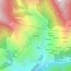
Ducheshwar topographic map

Click on the map to display elevation.

About this map

Name: Ducheshwar topographic map, elevation, terrain.

Location: Ducheshwar, Nuwakot, Bagamati Province, Nepal (27.87682 85.36312 28.08300 85.49744)

Average elevation: 2,467 m

Minimum elevation: 684 m

Maximum elevation: 5,073 m

Other topographic maps

Click on a map to view its topography, its elevation and its terrain.
Bidur

Nepal > Bagamati Province > Nuwakot

Average elevation: 693 m

Kakani

Nepal > Bagamati Province > Nuwakot > Kakani

Average elevation: 1,711 m

Bidur

Nepal > Bagamati Province > Nuwakot

Average elevation: 693 m

Shikharbesi

Nepal > Bagamati Province > Nuwakot

Average elevation: 1,937 m

Kharanitar VDC

Nepal > Bagamati Province > Nuwakot

Average elevation: 880 m

Gear up for your next adventure:

🔦LED Headtorch - Bright and durable light for night activities
🧦Outdoor Socks - Durable socks designed for hiking and outdoor sports
🪑Insulated Seat Pad - Protect your seat from cold rocks and wet logs
🥾Trail Hiking Shoes - Durable shoes designed for rugged trails
🧴Bear Spray Holster - Quick-access carry for essential Canadian wilderness safety

As an Amazon Associate, this site earns from qualifying purchases at no extra cost to you.