Geolocate

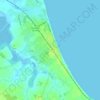
Johnstown Castle topographic map

Click on the map to display elevation.

About this map

Name: Johnstown Castle topographic map, elevation, terrain.

Location: Johnstown Castle, The Statue Walk, Rathaspick ED, The Borough District of Wexford, County Wexford, Leinster, Y35 HP22, Ireland (52.29389 -6.50590 52.29428 -6.50479)

Average elevation: 58 m

Minimum elevation: 22 m

Maximum elevation: 102 m

Other topographic maps

Click on a map to view its topography, its elevation and its terrain.
Gear up for your next adventure:

⛺Bushcraft Tarp - Versatile emergency shelter or gear protection
🥾Mountaineering Boots - Supportive boots for climbing and high-altitude hiking
🚲Handlebar Phone Mount - View topographic-map.com live while cycling
🧢Hiking Sun Hat - Wide-brimmed protection for exposed mountain ridges
❄️Traction Ice Cleats - Slip-on spikes for icy trails and winter hiking

As an Amazon Associate, this site earns from qualifying purchases at no extra cost to you.