Geolocate

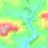
Rosetown topographic map

Click on the map to display elevation.

About this map

Name: Rosetown topographic map, elevation, terrain.

Location: Rosetown, Rosslare ED, The Borough District of Wexford, County Wexford, Leinster, Ireland (52.26232 -6.39335 52.26800 -6.37991)

Average elevation: 3 m

Minimum elevation: -3 m

Maximum elevation: 14 m

Other topographic maps

Click on a map to view its topography, its elevation and its terrain.
Hollyfort

Ireland > County Wexford

Average elevation: 145 m

Gear up for your next adventure:

🥘Camping Cookware Set - Compact nesting pots and pans for trail cooking
🧢Outdoor Visor - Breathable visor for sunny hikes
🩹Moleskin Blister Pads - Direct protection for painful foot pressure points
🧭GPS Tracker - Track your location in remote areas safely
🧥Packable Rain Jacket - Breathable waterproof layer for unpredictable weather

As an Amazon Associate, this site earns from qualifying purchases at no extra cost to you.