Geolocate

Pyecombe topographic map

Click on the map to display elevation.

About this map
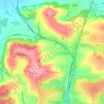
Name: Pyecombe topographic map, elevation, terrain.

Location: Pyecombe, Mid Sussex, West Sussex, England, United Kingdom (50.87973 -0.18406 50.91406 -0.13340)

Average elevation: 132 m

Minimum elevation: 48 m

Maximum elevation: 228 m

Gear up for your next adventure:

⛺Camping Tent - Weather-resistant tents suitable for 2 to 6 people
⛺Camping Essentials - All-in-one gear for a comfortable camping trip
🛰️Satellite Messenger - Emergency communication for areas with no cell service
🎒Fully Waterproof Backpack - Total protection for photography gear and electronics
🔭Compact Binoculars - Lightweight optics for scouting trails and wildlife

As an Amazon Associate, this site earns from qualifying purchases at no extra cost to you.