Geolocate

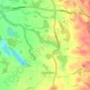
Siddington topographic map

Click on the map to display elevation.

About this map

Name: Siddington topographic map, elevation, terrain.

Location: Siddington, Cheshire East, England, United Kingdom (53.21937 -2.25986 53.26109 -2.19632)

Average elevation: 99 m

Minimum elevation: 58 m

Maximum elevation: 142 m

Other topographic maps

Click on a map to view its topography, its elevation and its terrain.
Gear up for your next adventure:

🧥Waterproof Pants - Keep dry during rainy hiking conditions
🥾Trail Hiking Boots - Supportive boots for rough trails
🥾Waterproof Hiking Boots - Boots keeping your feet dry in wet conditions
🧤Thermal Hiking Gloves - Grip-enhanced gloves for cold-weather altitude trekking
⛺Camping Tent - Weather-resistant tents suitable for 2 to 6 people

As an Amazon Associate, this site earns from qualifying purchases at no extra cost to you.