

Lodève topographic map
Click on the map to display elevation.
About this map
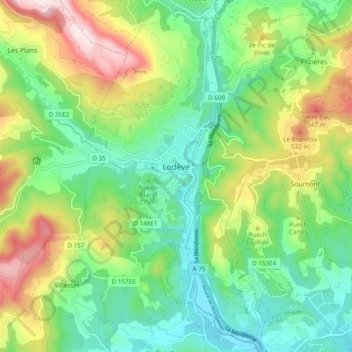
Name: Lodève topographic map, elevation, terrain.
Location: Lodève, Hérault, Occitanie, France métropolitaine, 34700, France (43.69426 3.25223 43.76397 3.34241)
Average elevation: 306 m
Minimum elevation: 122 m
Maximum elevation: 658 m
Other topographic maps
Click on a map to view its topography, its elevation and its terrain.


Brassac
France > Occitanie > Hérault > Saint-Pons-de-Thomières > Saint-Pons-de-Thomières
Average elevation: 601 m









La Trivalle
France > Occitanie > Hérault > La Vacquerie-et-Saint-Martin-de-Castries
Average elevation: 667 m


Chalet de La Vacquerie
France > Occitanie > Hérault > La Vacquerie-et-Saint-Martin-de-Castries
Average elevation: 670 m


