Geolocate

Calquières topographic map

Click on the map to display elevation.

About this map
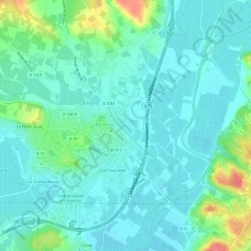
Name: Calquières topographic map, elevation, terrain.

Location: Calquières, Pézenas, Béziers, Hérault, Occitanie, France métropolitaine, 34120, France (43.44100 3.40730 43.48100 3.44730)

Average elevation: 26 m

Minimum elevation: 11 m

Maximum elevation: 81 m

Other topographic maps

Click on a map to view its topography, its elevation and its terrain.

34120

France > Occitanie > Hérault > Pézenas > Le Petit Larzac

Average elevation: 29 m

Gear up for your next adventure:

⛺Camping Essentials - All-in-one gear for a comfortable camping trip
🔦LED Flashlight - Powerful and long-lasting flashlight for camping and emergencies
🧤Insulated Winter Gloves - Heavy-duty protection for sub-zero Canadian adventures
🛰️Satellite Messenger - Emergency communication for areas with no cell service
🥾Trail Running Shoes - Lightweight and durable shoes for trail running

As an Amazon Associate, this site earns from qualifying purchases at no extra cost to you.