
Make a donation
Gear up for your next adventure:
As an Amazon Associate, this site earns from qualifying purchases at no extra cost to you.
Baar-Ebenhausen topographic map
Click on the map to display elevation.
Make a donation
Gear up for your next adventure:
As an Amazon Associate, this site earns from qualifying purchases at no extra cost to you.
Baar-Ebenhausen
Seit 2011 ist der Bahnhof Baar-Ebenhausen im Ortsteil Ebenhausen an der Bahnstrecke München–Treuchtlingen in Betrieb. Zuvor gab es weiter südlich in Baar einen Bahnhof, der aber seit jeher den Namen des benachbarten Reichertshofen trug. Um höhere Geschwindigkeiten in diesem Abschnitt zu erreichen, wurde der Verlauf der Bahnlinie jedoch begradigt, was eine Verlegung des Bahnhofes nach Norden und die Umbenennung zur Folge hatte. Der Bahnhof Baar-Ebenhausen wird im Stundentakt von Regionalbahnen und Regional-Express-Zügen der Relation (Nürnberg–)Treuchtlingen–Ingolstadt–München bedient.
Make a donation
Gear up for your next adventure:
As an Amazon Associate, this site earns from qualifying purchases at no extra cost to you.
About this map
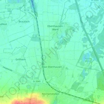
Name: Baar-Ebenhausen topographic map, elevation, terrain.
Average elevation: 374 m
Minimum elevation: 362 m
Maximum elevation: 418 m
Make a donation
Gear up for your next adventure:
As an Amazon Associate, this site earns from qualifying purchases at no extra cost to you.
Other topographic maps
Click on a map to view its topography, its elevation and its terrain.
Hartacker
Deutschland > Bayern > Landkreis Pfaffenhofen an der Ilm > Vohburg an der Donau
Average elevation: 359 m
Englmannszell
Deutschland > Bayern > Landkreis Pfaffenhofen an der Ilm > Eulenried
Average elevation: 404 m