Geolocate

Bergsjö topographic map

Click on the map to display elevation.

About this map

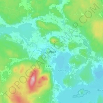
Name: Bergsjö topographic map, elevation, terrain.

Location: Bergsjö, Nordanstigs kommun, Gävleborg County, 829 50, Sweden (61.94378 17.01837 62.02378 17.09837)

Average elevation: 92 m

Minimum elevation: 36 m

Maximum elevation: 286 m

Other topographic maps

Click on a map to view its topography, its elevation and its terrain.

Gävle

Sweden > Gävleborg County

Average elevation: 28 m

Gran

Sweden > Gävleborg County > Gnarp District

Average elevation: 0 m

Ljusdals kommun

Sweden > Gävleborg County

Average elevation: 315 m

Disan

Sweden > Gävleborg County

Average elevation: 43 m

Hamra

Sweden > Gävleborg County

Average elevation: 437 m

Hamra

Sweden > Gävleborg County

Average elevation: 437 m

Hudiksvalls kommun

Sweden > Gävleborg County

Average elevation: 95 m

Hamra

Sweden > Gävleborg County

Average elevation: 437 m

Söderhamns kommun

Sweden > Gävleborg County

Average elevation: 67 m

Gnarp District

Sweden > Gävleborg County

Average elevation: 32 m

Gävle kommun

Sweden > Gävleborg County

Average elevation: 61 m

Ovanåkers kommun

Sweden > Gävleborg County

Average elevation: 269 m

Hofors kommun

Sweden > Gävleborg County

Average elevation: 147 m

Gear up for your next adventure:

🥾Mountain Trail Shoes - High-traction shoes for mountain trails
🧢Sun Protection Cap - Breathable cap to protect from sun exposure
🧤Rechargeable Heated Gloves - Extreme warmth for Canadian winter expeditions
🥾Waterproof Hiking Boots - Essential footwear for rugged terrain and wet Canadian trails
🥘Camping Cookware Set - Compact nesting pots and pans for trail cooking

As an Amazon Associate, this site earns from qualifying purchases at no extra cost to you.