Geolocate

Ilo topographic map

Click on the map to display elevation.

About this map

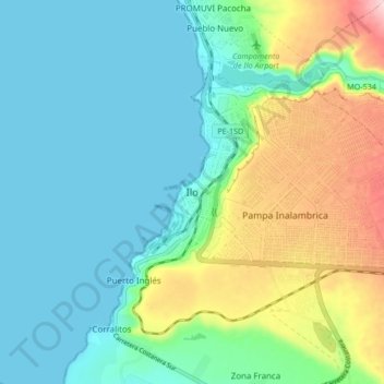
Name: Ilo topographic map, elevation, terrain.

Location: Ilo, Province of Ilo, Moquegua, 18601, Peru (-17.68588 -71.38520 -17.60588 -71.30520)

Average elevation: 74 m

Minimum elevation: 0 m

Maximum elevation: 284 m

Gear up for your next adventure:

🧰Emergency Multi-Tool - Compact multi-tool for outdoor survival
🧥Waterproof Hiking Jacket - Protect yourself from rain and wind while hiking
🏃Hydration Running Vest - Carry water and maps close to your body for speed
🪜Heavy Duty Carabiners - Multi-use clips for securing gear to your backpack
Backpacking Tent - Lightweight tent for long-distance hiking trips

As an Amazon Associate, this site earns from qualifying purchases at no extra cost to you.