Geolocate

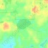
Green Lake County topographic map

Click on the map to display elevation.

About this map

Name: Green Lake County topographic map, elevation, terrain.

Location: Green Lake County, Wisconsin, United States (43.63175 -89.24556 43.98357 -88.88511)

Average elevation: 263 m

Minimum elevation: 228 m

Maximum elevation: 334 m

Other topographic maps

Click on a map to view its topography, its elevation and its terrain.
Minocqua

United States > Wisconsin > Oneida County

Average elevation: 491 m

Flora Lake

United States > Wisconsin > Langlade County

Average elevation: 436 m

Clam Lake

United States > Wisconsin > Ashland County

Average elevation: 441 m

Yellow Lake

United States > Wisconsin > Burnett County

Average elevation: 292 m

Orr Lake

United States > Wisconsin > Polk County

Average elevation: 277 m

Lauderdale

United States > Wisconsin > Walworth County

Average elevation: 279 m

Mount Thom

United States > Wisconsin > Monroe County

Average elevation: 341 m

Red Cedar

United States > Wisconsin > Dunn County

Average elevation: 233 m

Dorothy Lake

United States > Wisconsin > Florence County

Average elevation: 436 m

Hope

United States > Wisconsin > Dane County

Average elevation: 269 m

Bob Lake

United States > Wisconsin > Chippewa County

Average elevation: 335 m

Gear up for your next adventure:

🧶550 Survival Paracord - Versatile utility cord for emergency repairs and rigging
💡Portable Camping Lamp - Rechargeable lamp for campsite lighting
🧥Thermal Fleece Jacket - Versatile insulation for changing mountain temperatures
🕶️Polarized Sunglasses - Reduces glare from snow and water at high elevations
🪜Heavy Duty Carabiners - Multi-use clips for securing gear to your backpack

As an Amazon Associate, this site earns from qualifying purchases at no extra cost to you.