Geolocate

Sobral topographic map

Click on the map to display elevation.

About this map
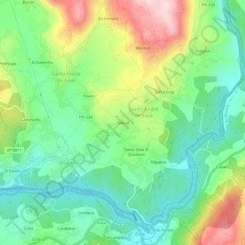
Name: Sobral topographic map, elevation, terrain.

Location: Sobral, Xeve, Pontevedra, Galicia, 36150, España (42.44334 -8.60969 42.48334 -8.56969)

Average elevation: 110 m

Minimum elevation: 1 m

Maximum elevation: 309 m

Other topographic maps

Click on a map to view its topography, its elevation and its terrain.

Lérez

España > Galicia > Pontevedra > Pontevedra

Average elevation: 67 m

Campañó

España > Galicia > Pontevedra > Pontevedra

Average elevation: 136 m

Campañó

España > Galicia > Pontevedra > Pontevedra

Average elevation: 136 m

Gear up for your next adventure:

🥾Approach Boots - Comfortable boots for hiking and climbing approaches
🔦LED Flashlight - Powerful and long-lasting flashlight for camping and emergencies
🛶Kayak Dry Bag - Waterproof storage for kayaking adventures
🥾Waterproof Trail Shoes - Shoes designed to handle wet terrain
🌬️Windproof Camp Stove - Efficient cooking even on exposed mountain peaks

As an Amazon Associate, this site earns from qualifying purchases at no extra cost to you.