Geolocate

Kapar topographic map

Click on the map to display elevation.

About this map

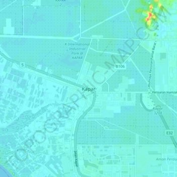
Name: Kapar topographic map, elevation, terrain.

Location: Kapar, Klang City, Klang, Selangor, 42200, Malaysia (3.09775 101.33321 3.17775 101.41321)

Average elevation: 5 m

Minimum elevation: 0 m

Maximum elevation: 52 m

Other topographic maps

Click on a map to view its topography, its elevation and its terrain.

Indah Island

Malaysia > Selangor > Klang City

Average elevation: 3 m

The Boss

Malaysia > Selangor > Klang City

Average elevation: 9 m

Indah Island

Malaysia > Selangor > Klang City

Average elevation: 3 m

Bukit Kapar

Malaysia > Selangor > Klang City

Average elevation: 24 m

Gear up for your next adventure:

👟Leg Gaiters - Keep debris, mud, and snow out of your boots
🧥Insulated Jacket - Keep warm in cold outdoor conditions
🌬️Windproof Camp Stove - Efficient cooking even on exposed mountain peaks
🥾Hiking Leggings - Comfortable leggings for outdoor activities
🧊Insulated Water Bottle - Keeps drinks cold in summer and prevents freezing in winter

As an Amazon Associate, this site earns from qualifying purchases at no extra cost to you.