Geolocate

Little Dunmow topographic map

Click on the map to display elevation.

About this map

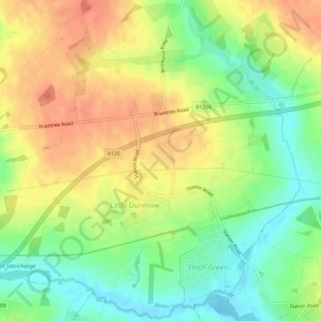
Name: Little Dunmow topographic map, elevation, terrain.

Location: Little Dunmow, Uttlesford, Essex, England, United Kingdom (51.85529 0.37926 51.88588 0.42969)

Average elevation: 69 m

Minimum elevation: 44 m

Maximum elevation: 92 m

Gear up for your next adventure:

🔋Emergency Crank Radio - Weather alerts and power without needing batteries
Lightweight Backpacking Tent - Compact tent for efficient hiking trips
🧤Insulated Winter Gloves - Heavy-duty protection for sub-zero Canadian adventures
🥾Hiking Boots - Sturdy boots providing ankle support and traction on rugged trails
🥾Light Trekking Boots - Supportive boots for multi-day treks

As an Amazon Associate, this site earns from qualifying purchases at no extra cost to you.