Geolocate

Chuquicara topographic map

Click on the map to display elevation.

About this map

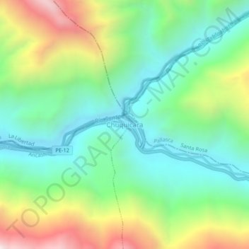
Name: Chuquicara topographic map, elevation, terrain.

Location: Chuquicara, Chimbote, Santa, Áncash, Perú (-8.67477 -78.25627 -8.63477 -78.21627)

Average elevation: 898 m

Minimum elevation: 470 m

Maximum elevation: 1,742 m

Other topographic maps

Click on a map to view its topography, its elevation and its terrain.

Rio Lacramarca

Perú > Áncash > Chimbote

Average elevation: 9 m

Gear up for your next adventure:

🧴Waterproofing Spray - Restore the DWR coating on jackets and tents
🕯️Camping Lantern - Illuminates your entire campsite with high-efficiency LEDs
🪜Heavy Duty Carabiners - Multi-use clips for securing gear to your backpack
🚲Bike Repair Kit - Essential tools for on-trail mechanical issues
🔋Lithium AA Batteries - Long-lasting power that performs in extreme cold

As an Amazon Associate, this site earns from qualifying purchases at no extra cost to you.