Geolocate

Thurmaston topographic map

Click on the map to display elevation.

About this map

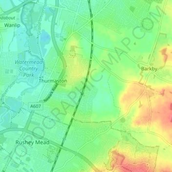
Name: Thurmaston topographic map, elevation, terrain.

Location: Thurmaston, Charnwood, Leicestershire, England, United Kingdom (52.66315 -1.11672 52.69229 -1.05124)

Average elevation: 62 m

Minimum elevation: 43 m

Maximum elevation: 96 m

Gear up for your next adventure:

🚲Heavy Duty Bike Lock - Secure your bike at the trailhead or during stops
🕯️Camping Lantern - Illuminates your entire campsite with high-efficiency LEDs
🥫Freeze-Dried Meals - Lightweight, high-calorie nutrition for multi-day treks
🕶️Polarized Sunglasses - Protect your eyes with durable polarized lenses
🪑Ultralight Camping Stool - Compact seating for rest stops during long hikes

As an Amazon Associate, this site earns from qualifying purchases at no extra cost to you.