Geolocate

Tryfan topographic map

Click on the map to display elevation.

About this map

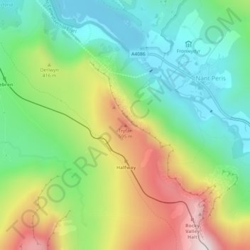
Name: Tryfan topographic map, elevation, terrain.

Location: Tryfan, Nant Peris, Gwynedd, Wales, LL55 4UE, United Kingdom (53.09940 -4.09627 53.09950 -4.09617)

Average elevation: 333 m

Minimum elevation: 92 m

Maximum elevation: 740 m

Gear up for your next adventure:

🛁Quick-Dry Microfiber Towel - Space-saving towel that dries rapidly on the move
🛶Kayak Dry Bag - Waterproof storage for kayaking adventures
🔥Emergency Fire Starter - Reliable ignition source for all weather conditions
🧰Multitool Knife - Compact and versatile tool for outdoor use
💧Hydration Bladder - Hands-free hydration solution for long treks

As an Amazon Associate, this site earns from qualifying purchases at no extra cost to you.