
Dale topographic map
Click on the map to display elevation.
About this map
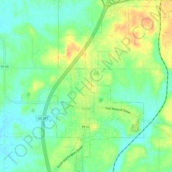
Name: Dale topographic map, elevation, terrain.
Location: Dale, Spencer County, Indiana, United States (38.15532 -87.00025 38.19223 -86.96400)
Average elevation: 138 m
Minimum elevation: 122 m
Maximum elevation: 160 m
Other topographic maps
Click on a map to view its topography, its elevation and its terrain.