Geolocate

Winslow topographic map

Click on the map to display elevation.

About this map

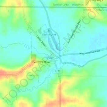
Name: Winslow topographic map, elevation, terrain.

Location: Winslow, Stephenson County, Illinois, United States (42.48629 -89.80275 42.50125 -89.78950)

Average elevation: 247 m

Minimum elevation: 232 m

Maximum elevation: 276 m

Other topographic maps

Click on a map to view its topography, its elevation and its terrain.

Gear up for your next adventure:

🛶Kayak Accessories - Essential gear for safe and fun kayaking adventures
🧴Bear Spray Holster - Quick-access carry for essential Canadian wilderness safety
🧶550 Survival Paracord - Versatile utility cord for emergency repairs and rigging
🧢Beanie Hat - Keep your head warm in cold weather
🔦UV Flashlight - Detect minerals or specific insects in the dark

As an Amazon Associate, this site earns from qualifying purchases at no extra cost to you.