Geolocate

Blue Ridge Mountains topographic map

Interactive map

Click on the map to display elevation.

About this map

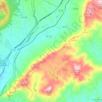
Name: Blue Ridge Mountains topographic map, elevation, terrain.

Location: Blue Ridge Mountains, Botetourt County, Virginia, United States (37.29428 -79.87675 37.37389 -79.77596)

Average elevation: 460 m

Minimum elevation: 290 m

Maximum elevation: 774 m

Although the term "Blue Ridge" is sometimes applied exclusively to the eastern edge or front range of the Appalachian Mountains, the geological definition of the Blue Ridge province extends westward to the Ridge and Valley area, encompassing the Great Smoky Mountains, the Great Balsams, the Roans, the Blacks, and other mountain ranges. To the east, two lower elevation ranges referred to as foothills are also often included as "spurs" of the Blue Ridge: the Brushy Mountains and the South Mountains.

Wikipedia (CC-BY-SA 3.0)

Other topographic maps

Click on a map to view its topography, its elevation and its terrain.

Fincastle

United States > Virginia > Botetourt County

Fincastle, Botetourt County, Virginia, 24090, United States

Average elevation: 363 m

Troutville

United States > Virginia > Botetourt County

Troutville, Botetourt County, Virginia, United States

Average elevation: 458 m

Eagle Rock

United States > Virginia > Botetourt County

Eagle Rock, Botetourt County, Virginia, 24085, United States

Average elevation: 379 m

Daleville

United States > Virginia > Botetourt County

Daleville, Botetourt County, Virginia, 24083, United States

Average elevation: 410 m

Cloverdale

United States > Virginia > Botetourt County

Cloverdale, Runaway Village, Botetourt County, Virginia, United States

Average elevation: 401 m

Oriskany

United States > Virginia > Botetourt County

Oriskany, Botetourt County, Virginia, 24130, United States

Average elevation: 404 m

Glen Wilton

United States > Virginia > Botetourt County

Glen Wilton, Botetourt County, Virginia, 24438, United States

Average elevation: 363 m

Coyner Mountain Overlook

United States > Virginia > Botetourt County

Coyner Mountain Overlook, Botetourt County, Virginia, 25012, United States

Average elevation: 381 m

Daleville

United States > Virginia > Botetourt County

Daleville, Botetourt County, Virginia, 24083, United States

Average elevation: 412 m

Haden

United States > Virginia > Botetourt County > Haden

Haden, Botetourt County, Virginia, 24438, United States

Average elevation: 339 m

Buchanan

United States > Virginia > Botetourt County

Buchanan, Botetourt County, Virginia, 24066, United States

Average elevation: 344 m

Laymantown

United States > Virginia > Botetourt County > Laymantown

Laymantown, Botetourt County, Virginia, United States

Average elevation: 412 m

Blue Ridge

United States > Virginia > Botetourt County

Blue Ridge, Botetourt County, Virginia, United States

Average elevation: 472 m