Geolocate

Cloverdale topographic map

Click on the map to display elevation.

About this map

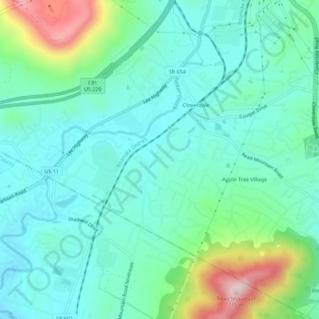
Name: Cloverdale topographic map, elevation, terrain.

Location: Cloverdale, Botetourt County, Virginia, United States (37.33791 -79.92953 37.37844 -79.88093)

Average elevation: 401 m

Minimum elevation: 311 m

Maximum elevation: 698 m

Gear up for your next adventure:

🧥Ultralight Puffy Jacket - Maximum warmth that packs down to the size of an orange
🏃Hydration Running Vest - Carry water and maps close to your body for speed
🧥Thermal Fleece Jacket - Versatile insulation for changing mountain temperatures
🛶Canoe Life Vest - Safety vest for water sports
🦟Insect Repellent - Keep mosquitoes and black flies away in wooded areas

As an Amazon Associate, this site earns from qualifying purchases at no extra cost to you.