Geolocate

Huaran topographic map

Click on the map to display elevation.

About this map
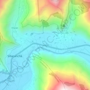
Name: Huaran topographic map, elevation, terrain.

Location: Huaran, Arin, Calca, Province of Calca, Cusco, 08471, Peru (-13.33081 -72.03905 -13.29081 -71.99905)

Average elevation: 3,191 m

Minimum elevation: 2,874 m

Maximum elevation: 4,007 m

Gear up for your next adventure:

🕯️Camping Lantern - Illuminates your entire campsite with high-efficiency LEDs
🧢Hiking Hat - Sun-protective and breathable hats for long treks
🧢Outdoor Visor - Breathable visor for sunny hikes
🧥Waterproof Pants - Keep dry during rainy hiking conditions
🧤Thermal Hiking Gloves - Grip-enhanced gloves for cold-weather altitude trekking

As an Amazon Associate, this site earns from qualifying purchases at no extra cost to you.